The 8-mile-wide meeting of Cross Sound and the open Pacific can be rowdy, particularly on an ebb tide with wind from any direction off the ocean. As with most of the entrances on this coast, it is best transited at high water slack or on the flood if there is wind from the south or west. Get local knowledge at Elfin Cove or Pelican to plan the best time for crossing. Cross Sound is transited by cruise ships and barges as well as all kinds of fishing vessels so keep an exceptionally sharp watch, particularly in fog or other reduced visibility.
The first waypoint on the trip northwest is Cape Spencer Light, a prominent lighthouse on a small island surrounded by rocks and reefs. Most mariners heading up the coast give the cape a wide berth, staying well to seaward, to access any of the bays between there and Icy Point or to continue on. Only the most committed “gunk-holer,” or anyone suddenly slammed with adverse weather, will be tempted to slide up into the sheltered waters of Dicks Arm. To do so, pass to the north before reaching the light and round to the west the unnamed island just north of the one on which the lighthouse is located. After passing through a kelp-lined channel, as the inlet of Dick’s Arm becomes apparent, enter through a narrow passage between sets of rocks. Once inside the 2-mile-long fjord that in places is no more than 200 yards wide, anchorage is possible almost anywhere except where a tide flat extends a half mile out from the head of the inlet. The steep spruce-covered slopes show signs of landslides or avalanches and the arm is a good place to look for brown bears and other wildlife.
Departure from Dicks Arm is via an unmarked passage east of Zip Rock, well to the west of Cape Spencer Light.
Lands on shore from Cape Spencer to the Alsek River are part of Glacier Bay National Park and Preserve.
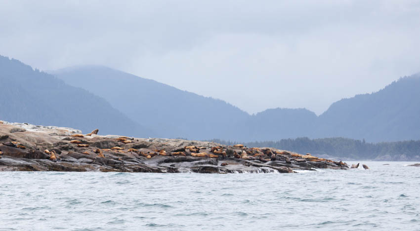
Although the indented coast west of the cape offers numerous temptations, most mariners continue onward, staying well clear of the rocks at Pt. Villaluenga and Polka Rock, and round the north side of Graves Rocks. In west winds it’s possible to avoid some of the slop by taking the narrow 5-fathom channel to the east of the rocks, but that involves threading between kelp beds. A thousand Steller sea lions haul out on Graves Rocks and although they are not part of the endangered western stock and therefore aren’t protected by a 3-mile no-transit zone, it is still a violation of the Marine Mammal Protection Act to disturb them.
Between Graves Rocks and a marker on a rock east of Libby Island is a deep and mile-wide passage into Graves Harbor, which offers some anchoring options. Trollers prefer Murphy Cove since it’s a short run to the fishing grounds. Mosquito Cover (local name, not on NOAA charts) in the back southeast corner of the bay is more sheltered and has lots of swinging room. Beware that a small triangle marker in what appears to be the middle of the bay indicates the end of a reef that extends out from the south side of the entrance—resist the urge to cut the corner. The northern arm of Graves Harbor, called Murk Bay, is less popular as an anchorage because it is deep and open to ocean swell. The presence of the massive Brady Glacier only 4 miles east keeps evening temperatures cool as a breeze sweeps down the mountain pass.
It is prudent to pass well outside Libby Island on the way west due to offshore wash rocks. Next up the line is Torch Bay, which is somewhat open to swell from the ocean, although a small bight in the northeast corner offers adequate anchorage. Watch for offshore wash rocks at the approach to Torch Bay.
Dixon Harbor also is used by fishing vessels and a rocky bight in the southeast corner offers shelter to a vessel that can get its anchor to bite into the hard bottom in 10-18 fathoms. A derelict workboat lies rusting in the tidal pass between Sugarloaf Island and the Hankinson Peninsula. The Coast Pilot describes Thistle Cove as an anchorage, and the chart indicates a minimum of 2 fathoms at the entrance and deeper water inside, but actual depths are less than charted and there is potential for grounding or going dry at low water on the shoal in the entrance.
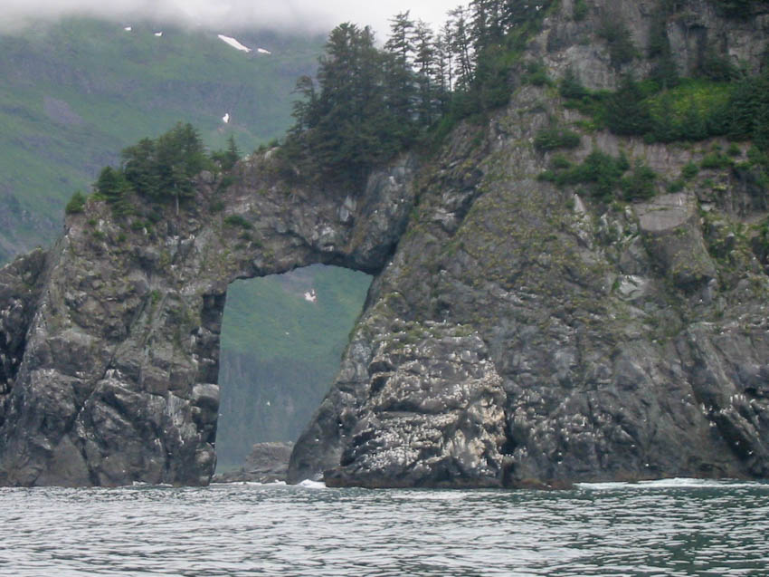
Both Astrolabe Bay and Boussole Bay offer protection from north and east winds but swells roll right in. There is a small bight offering protection from west and southwest breezes at the mouth of Kaknau Creek just east of Icy Point. These are the only possible anchorages on Palma Bay (also known as Icy Bay) and the last opportunities for shelter before Lituya Bay. A point of interest on the east side of Palma Bay is a 60-foot-high natural arch at the outer tip of Boussole Head. Beware of Alder Rock, awash about a half mile south of Boussole Head.


