
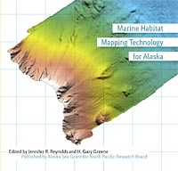
Overview: Marine Habitat Mapping Technology for Alaska
Jennifer R. Reynolds, H. Gary Greene, Doug Woodby, Jon Kurland, and Brian Allee
- Price: Free
 This is part of Marine Habitat Mapping Technology for Alaska
| Format | Price | |
|---|---|---|
| PDF download [153.2 KB] Bypass cart and download |
Free | Add to Cart |
Description
Benthic habitat mapping has become the principal method for defining the distribution of benthic habitats, and indicating or predicting the distribution of marine organisms that are closely associated with these habitats. The method is heavily dependent on technologies, both at remote sensing scales for creation of seafloor maps and at smaller scales, mainly visual and sampling activities, for direct characterization of the seafloor. Thus an understanding of what technologies are available, their capabilities, and how they might be used is essential to development of effective habitat mapping programs. This volume is a product of the Marine Habitat Mapping Technology Workshop for Alaska (April 2007), and contains papers developed from presentations by the invited speakers. The focus is on proven technologies that have capabilities appropriate for habitat mapping in Alaska waters. The context and need for benthic habitat mapping is discussed from the point of view of marine resource managers. Remote sensing technologies and their applications to habitat mapping are reviewed, including a variety of sonar mapping systems, mapping AUVs, small-boat surveys in shallow water, airborne LIDAR (light detection and ranging) bathymetry, and subbottom profiling. Visual scale technologies are also reviewed, including towed video sleds, small ROVs, the imaging AUV SeaBED, the manned submersible Delta, and methods of quantitative video analysis. Habitat classification schemes are discussed. Finally, several case histories of major habitat mapping programs are summarized as illustrations of several possible approaches to habitat mapping of large regions: Heceta Bank, Oregon; the Scotian Shelf; the Australian Exclusive Economic Zone; and the Irish National Seabed Survey. These case histories are relevant to development of strategies for habitat mapping at the scale of the Alaska region.
Item details
- Item number: AK-SG-08-03b
- Year: 2008
- DOI: https://doi.org/10.4027/mhmta.2008.01